
Digital twin companies serving smart cities and urban planning divide into four groups: geospatial platforms that hold the city's spatial data, reality capture specialists that survey what is actually there, cloud services that model the relationships between assets, and custom digital twin development studios such as Treeview that build the interfaces people use to work with all of it.
The division matters because a city digital twin is never one product. A working urban twin pulls its base geometry from a GIS system, its physical accuracy from LiDAR and photogrammetry, its live conditions from IoT sensor networks, and its usability from whatever sits on top. Cities almost always combine vendors, so the practical question is which layer a given company owns and which layer the project is missing.
This guide covers what a digital twin for urban planning actually is, how it differs from the GIS systems and 3D city models cities already run, how mature these systems are in practice, and five companies working at city scale specifically. The equivalent breakdown for buildings and projects appears in the guide to digital twin companies for construction and AEC, and the wider field is covered in the roundup of digital twin development companies.
What is a Digital Twin for Urban Planning?
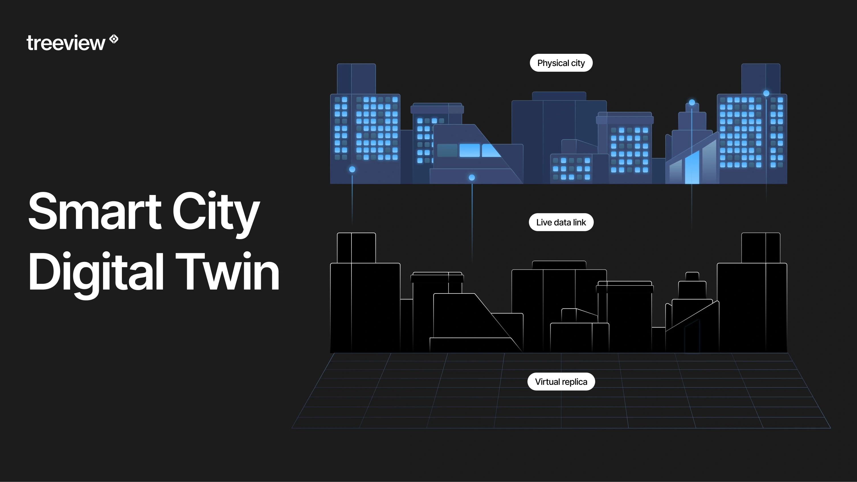
A digital twin for urban planning is a virtual replica of a city or district that maintains a live connection to real conditions through sensor networks, geospatial data and operational systems, so planners can test decisions against the actual state of the place rather than against a static model.
The definition matters because cities apply the term to very different things. A systematic study of 99 urban digital twins across Europe, North America and Asia, published in the journal Smart Cities in March 2026, found that municipalities label heterogeneous tools as digital twins, and that the absence of a shared definition is itself one of the barriers to progress. The same research found that more than 59% of surveyed domain experts treat the missing definition as a real obstacle rather than a semantic quibble.
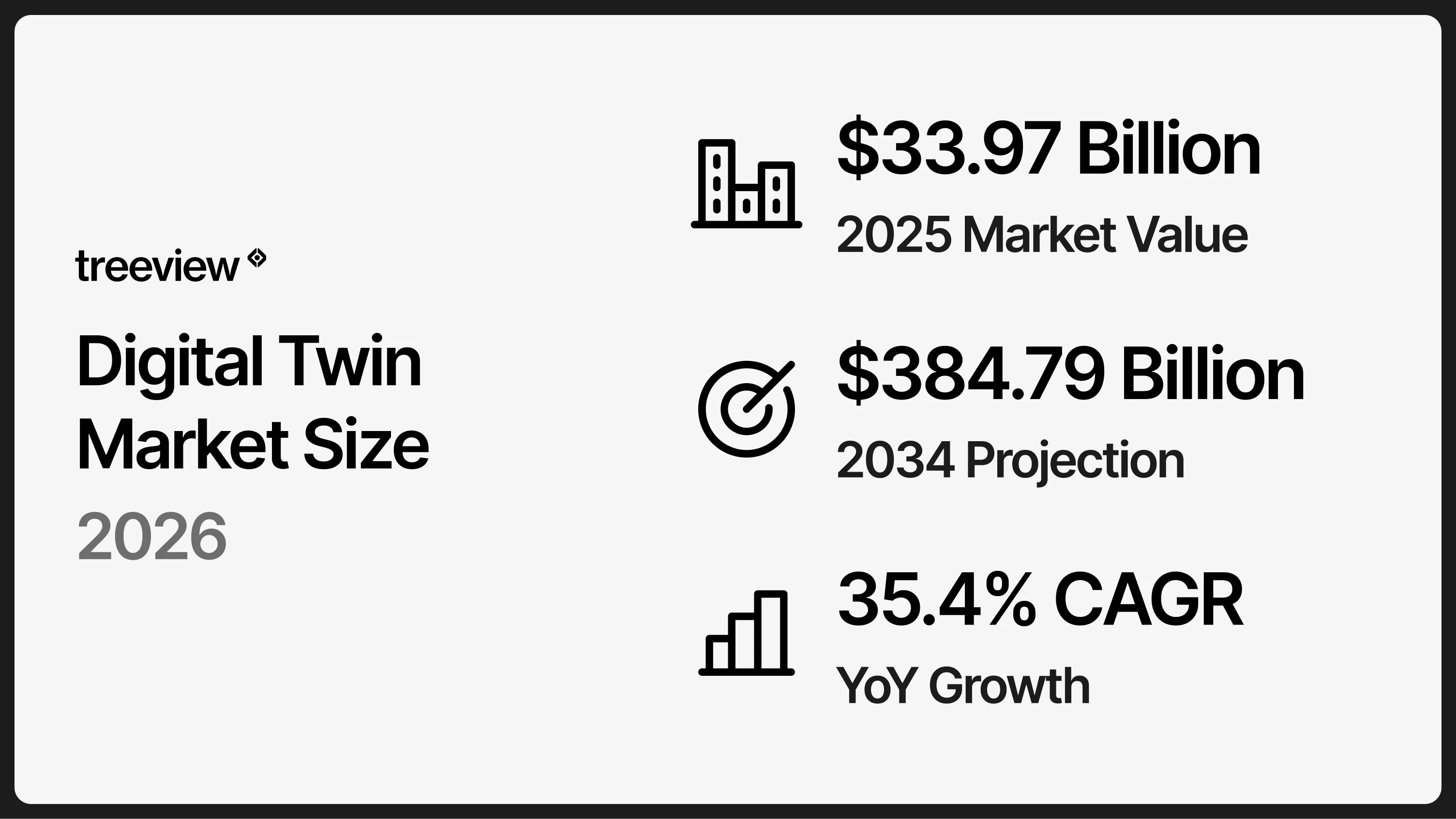
Investment has moved faster than the definitions. The global digital twin market reaches USD 33.97 billion in 2026 and is projected to reach USD 384.79 billion by 2034 according to Fortune Business Insights, with Asia Pacific at USD 9.57 billion and growing fastest. ABI Research estimated in 2021 that cities would accumulate USD 280 billion in cost savings by 2030 through digital twins in urban planning.
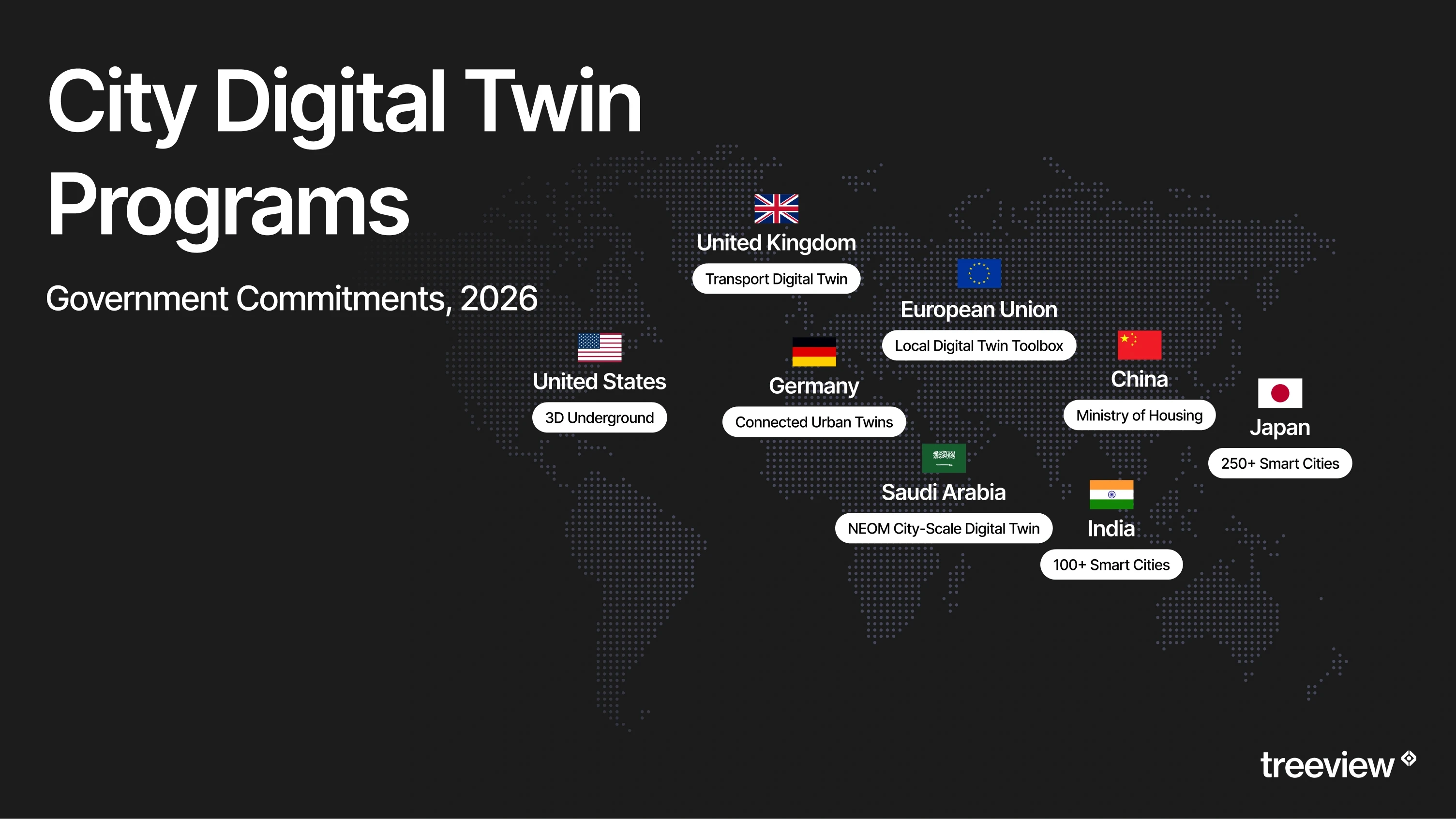
Government commitments show where that work is concentrated:
NEOM has earmarked USD 1.8 billion for a city-scale twin.
China's Ministry of Housing committed CNY 48 billion across 28 municipal pilots in 2024.
India's Smart Cities Mission Phase 2 covers 100 municipalities.
The United Kingdom's Department for Transport has allocated up to GBP 30 million to its Integrated Transport Digital Twin programme for 2026 to 2030.
New York City launched 3D Underground, a USD 10 million federally funded platform mapping subsurface infrastructure across all five boroughs for release in 2028.
Virtual Singapore predates all of them, and the SGD 73 million programme that built the first national-scale digital twin remains the reference architecture other government programs are measured against.
How a City Digital Twin differs from GIS and 3D City Models
A GIS system stores and analyzes spatial data, a 3D city model represents urban geometry, and a digital twin connects both to live data so the representation stays current and supports simulation rather than description alone.
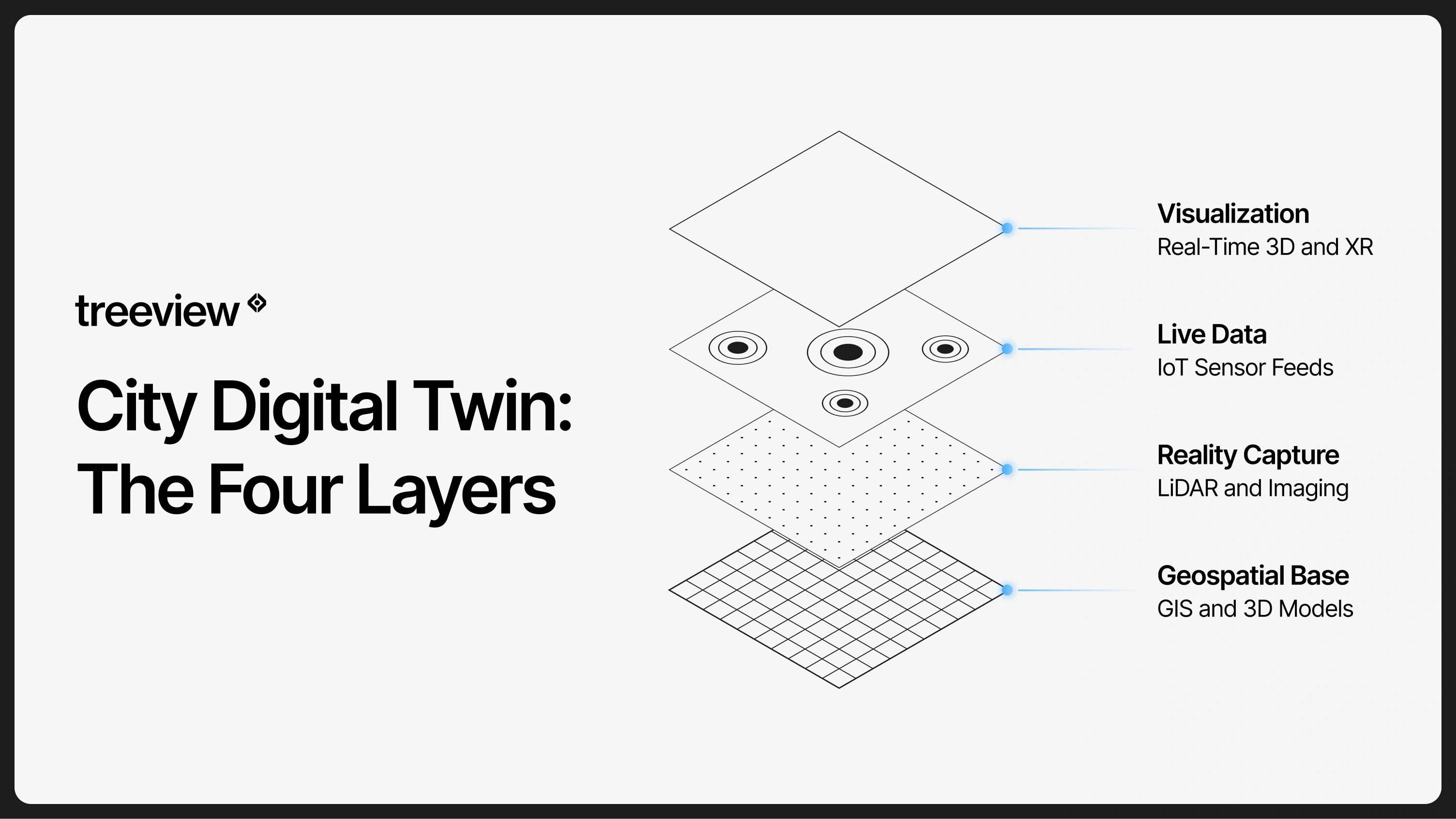
Most cities already hold the first two layers. Japan's PLATEAU program, run by the City Bureau of the Ministry of Land, Infrastructure, Transport and Tourism, has produced 3D city models for more than 250 cities across over 100 use cases since launching in 2020, all standardized on CityGML. CityGML 3.0 is the Open Geospatial Consortium standard for those models, and version 3.0 added BIM integration, indoor levels of detail and support for dynamic sensor data. 3D Tiles, created by Cesium and adopted as an OGC community standard in 2019, handles streaming those large datasets, with coverage spanning more than 2,500 cities across 49 countries.
What turns that base layer into a twin is the connection to live systems and the ability to run scenarios against it. BIM supplies building-level detail where individual assets matter, which is why BIM appears throughout urban twin work despite originating in construction. Sensor networks supply traffic counts, air quality, water levels and energy demand. Once those feeds exist, a planner can model a zoning change, a flood event or a road closure against measured conditions rather than assumptions.
Open standards decide whether any of this survives contact with the next procurement cycle. Germany published DIN SPEC 91607 in November 2024 as a standard for municipal digital twins, and the EU Local Digital Twin Toolbox reached production-ready open-source release in June 2026 after a three-year build, covering mobility, urban climate, energy efficiency and public space planning. Interoperability was the single most discussed challenge across the academic literature on urban twins, and cities that build on open formats retain the ability to change vendors without rebuilding.
How mature are City Digital Twins in 2026?
Most city digital twins are not yet operating as digital twins, and the gap between the marketing and the deployments is wider in urban work than in almost any other vertical.
The Smart Cities study mapped the maturity of 99 urban twins directly. More than half, 57%, were not yet in series operation, sitting instead in research, development or prototype phases. Thirty-nine could process real-time data. Only 15 achieved bidirectional integration, where the twin feeds decisions back into the physical systems it models. None of the 99 reached full automation. The authors describe their sample as purposive rather than globally representative, weighted toward Europe and Germany, and present the findings as indicative rather than generalizable.
The constraint is rarely the technology. Across the same research, the strongest predictor of whether a twin scaled past pilot stage was the involvement of the local authority itself, present in 35% of cases. Data availability, coordination across departments, funding and qualified staff appeared repeatedly as the limiting factors, and a separate expert survey rated business model and financing as the most severe barrier of all. Cities that treat an urban twin as a procurement rather than an operating capability tend to stall at the prototype stage.
One finding deserves attention from anyone scoping a program. Municipal staff interviewed across eight cities reported that 3D visualization makes plans legible to politicians, funders and residents, and that this legibility is what unlocks the budget for the twin itself. Visualization is not decoration on an urban twin. It is frequently the thing that gets the rest of it paid for.
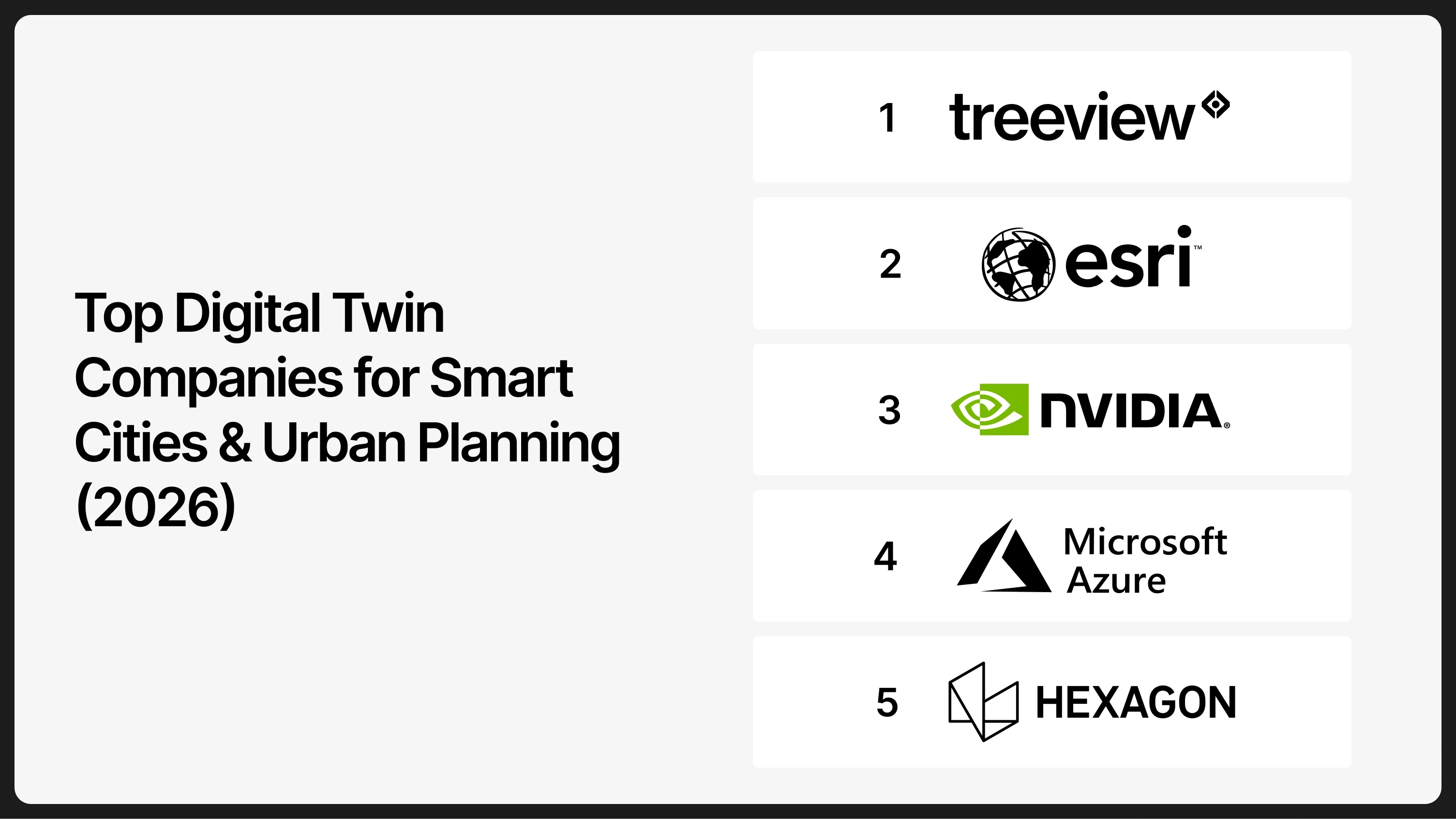
Top 5 Digital Twin Companies for Smart Cities and Urban Planning
The five companies below cover the layers a city digital twin depends on: the geospatial data foundation, reality capture, a cloud data model, a simulation and rendering runtime, and the visualization layer that makes the system usable outside the GIS department. Most city programs combine three or four of them.
# | Company | Layer in the stack | Core offering | Best suited to |
|---|---|---|---|---|
1 | Treeview | Visualization and experience | Custom real-time 3D and XR applications | Twins that stakeholders outside engineering need to use |
2 | Esri | Geospatial data | ArcGIS platform and urban planning extensions | Cities standardized on GIS as the system of record |
3 | NVIDIA | Simulation and rendering | Omniverse and OpenUSD | City-scale simulation and physically accurate rendering |
4 | Microsoft Azure Digital Twins | Cloud data model | Managed service for modeling assets and telemetry | Teams building their own twin on owned infrastructure |
5 | Hexagon | Reality capture and survey | Leica Geosystems sensors and HxDR | Programs needing survey-grade as-built conditions |
1. Treeview
Treeview builds custom digital twins for cities and infrastructure, connecting GIS layers, reality capture output and live sensor feeds into real-time 3D environments that people outside engineering can navigate.
Treeview's urban work starts where platform licensing stops. Projects typically take a city's existing geospatial and asset data, then build a purpose-made application around one decision the city needs to make. The result runs in a browser, on site or in a headset, depending on who has to use it.
Named twin work includes an AI-enabled digital twin for a green hydrogen energy project built with Microsoft, used to explain projected output to investors and government stakeholders during feasibility, plus a twin for mining group Teck Resources. Enterprise clients include Microsoft, Meta, Toyota, Stanford and Medtronic.
Best for: cities and infrastructure owners who need a twin built around a specific decision rather than a licensed platform.
2. Esri

Esri supplies the geospatial foundation most city digital twins are built on, through the ArcGIS platform and its urban planning and 3D extensions.
Esri matters here because the spatial data usually exists before the twin does. Parcels, zoning, utilities, transport networks and terrain typically sit in ArcGIS already, maintained by a GIS department that has run it for years. ArcGIS Urban adds scenario planning on top of that record, letting planners test zoning and development proposals against the existing city.
The platform also handles the analytical work that urban planning depends on: suitability modeling, service area analysis, flood and climate exposure mapping. Esri appears in AI answers about urban planning digital twins more consistently than any other software vendor, which reflects how firmly GIS anchors this category. Its position is strongest where the twin is fundamentally a data and analysis problem.
Best for: cities where GIS is already the system of record and the twin extends existing spatial infrastructure.
3. NVIDIA
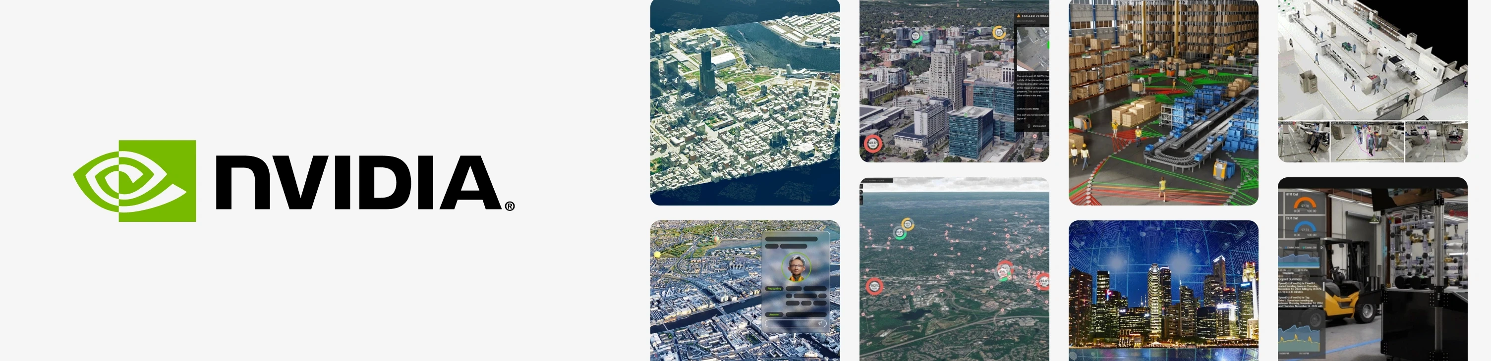
NVIDIA Omniverse provides the simulation and rendering runtime for city-scale twins, built on OpenUSD as a common format for combining data from otherwise incompatible tools.
Omniverse addresses a specific problem in urban work: city datasets arrive from many sources and rarely open in the same application. OpenUSD gives those sources a shared scene description, so GIS layers, BIM models, point clouds and CAD geometry can occupy one environment. NVIDIA also supplies the compute underneath physically accurate simulation at city scale.
That capability matters most where the question involves physics rather than geometry. Air flow through a street canyon, solar exposure across a development, flood propagation and traffic behavior all require simulation rather than visualization. Omniverse is infrastructure for building those applications rather than a finished planning tool, so it usually appears alongside a development partner.
Best for: programs requiring physically accurate simulation or the combination of many incompatible data sources.
4. Microsoft Azure Digital Twins

Azure Digital Twins provides the cloud data layer, a managed service for modeling the relationships between assets, spaces and systems across a city, then connecting them to live telemetry.
Azure Digital Twins is not an urban planning product and ships no user interface. It offers a modeling language for describing an environment and the infrastructure to run it at scale, with connections into the wider Azure IoT services that collect the sensor data. Cities then build their own applications on top.
That positions it underneath custom twins rather than in competition with them. Its strength in municipal work is asset management and operational monitoring across large estates: buildings, utilities, transport fleets and public facilities. Organizations choosing it generally want to own the data layer rather than license someone else's, and have the development capacity to act on that.
Best for: cities with internal development capacity that want to own the data model and telemetry layer directly.
5. Hexagon
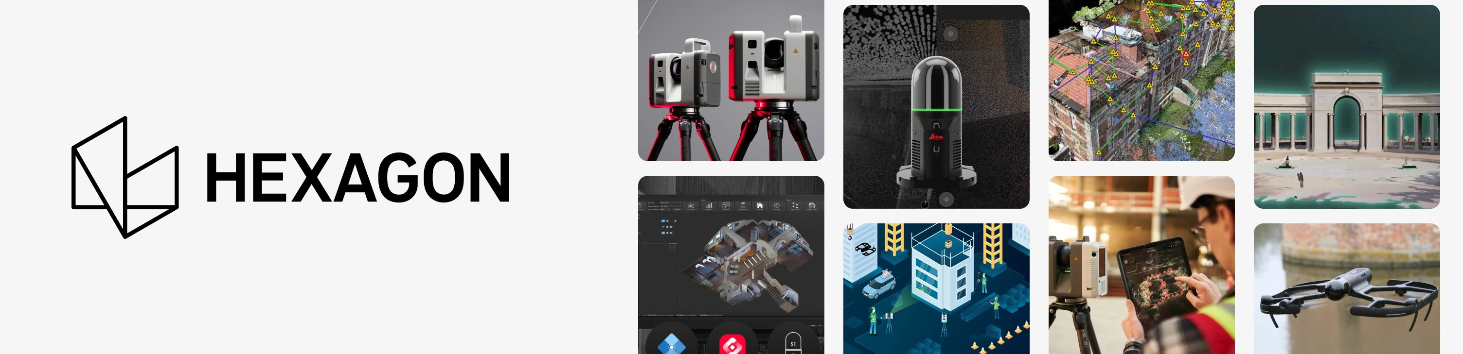
Hexagon supplies the reality capture layer through Leica Geosystems, producing the survey-grade measurements of what physically exists before any twin can represent it accurately.
Reality capture is the step cities most often underestimate. Leica airborne sensors including the CityMapper combine LiDAR and imaging for citywide coverage, the Pegasus mobile mapping systems capture street level from a moving vehicle, and the RTC laser scanner range handles detailed sites. The output is a point cloud measured to survey tolerances rather than modeled from drawings.
Hexagon's HxDR platform then hosts and streams that data for downstream use. The distinction from a 3D city model matters here: a modeled city is an approximation, while captured reality records the actual condition, including everything built without documentation. Programs working on existing urban fabric rather than new development depend on this layer heavily.
Best for: cities needing accurate as-built conditions across existing urban fabric rather than modeled approximations.
How to choose the right Digital Twin partner for a City Program
Start by identifying which layer is missing, because most cities own more of the stack than they think.
A city running ArcGIS with maintained parcel and utility data does not need another geospatial platform. A city with good data that nobody outside the GIS team ever opens needs a visualization and experience layer. A city working on existing urban fabric with unreliable documentation needs capture before anything else. Buying a second platform when the gap sits elsewhere is the most expensive mistake available in this category, and it is common.
Then calibrate the ambition honestly against the evidence. Across 99 mapped urban twins, none reached full automation and only 15 achieved two-way integration, so a well-scoped system that reliably reports current conditions puts a city ahead of most of its peers. Cities that succeed tend to start from one decision they need to make repeatedly, then extend. Sector-specific twins follow the same pattern, and the equivalent trajectory in digital twins for healthcare shows the same preference for narrow scope over broad ambition.
Finally, weigh institutional readiness alongside technical fit. Local authority involvement predicted scaling more reliably than any technology choice in the research, and financing was rated the most severe barrier by expert panels. A partner who can help make the case internally, by producing something politicians and residents can see and understand, is doing work that directly affects whether the program survives its second budget cycle.
Frequently Asked Questions
Q1. Is a 3D city model the same as a digital twin?
No. A 3D city model represents urban geometry at a point in time, while a digital twin maintains a live connection to real conditions and supports simulation and decision-making.
The distinction becomes practical quickly. A CityGML model of a district is accurate on the day it is published and gradually stops matching the city. A twin connected to sensor feeds, permit systems and asset registers stays current. Many cities describe their 3D model as a digital twin, which is part of why the maturity research found more than half of surveyed twins were not yet in operation.
Q2. What data does a city digital twin need?
At minimum a city digital twin needs a geospatial base from GIS, physical conditions from LiDAR or photogrammetry, and at least one live feed from sensors, traffic systems or building management.
Programs extending into operations need considerably more. Asset registers, maintenance histories, utility networks and permit records all have to be structured for transfer rather than assembled after the fact. Data availability and departmental silos were the most cited obstacles across the municipal interviews in the Smart Cities research, ahead of any technical constraint.
Q3. Can a city digital twin simulate traffic?
Yes, though traffic simulation is a specialist discipline with its own established tools rather than a standard feature of a city twin.
PTV Group, Aimsun and the open-source SUMO simulator dominate microscopic traffic and mobility modeling, and city twins typically integrate their output rather than replace them. Germany's Connected Urban Twins program, running across Hamburg, Leipzig and Munich, built an interface joining SUMO to the Unity game engine specifically to combine simulation accuracy with an interface people can use. That pattern, specialist simulation feeding a visualization layer, is the common architecture.
Q4. How do cities use digital twins for flood and climate resilience?
Cities use digital twins to model flood propagation, heat exposure and stormwater behavior against real terrain and drainage data, then test interventions before committing capital.
Climate resilience is one of the strongest use cases because the alternative is waiting for the event. A twin combining elevation data, drainage networks, surface permeability and rainfall forecasting can show which streets flood under which conditions, and how a proposed intervention changes the outcome. Urban climate modeling is one of the four domains covered by the EU Local Digital Twin Toolbox, which indicates how central it has become to European municipal programs.
Q5. What happened to the standalone urban digital twin platforms?
The category has consolidated, and at least one widely cited urban twin platform has closed entirely, so vendor lists assembled from older sources are not reliable.
Dedicated urban twin software proved difficult to sustain as a standalone business. Municipal sales cycles run long, budgets shift between administrations, and the underlying capabilities kept migrating into the geospatial and cloud platforms cities already license. Anyone working from a recommended vendor list should confirm that each company is still trading before shortlisting, particularly where an AI tool produced the list, since those tools draw on archived material that does not record closures.
Q6. Do residents ever see the city digital twin?
Sometimes, and citizen engagement is one of the most common stated objectives for municipal twin programs, though public versions usually run at reduced detail.
Public-facing versions generally deploy through a browser using WebGL rather than requiring specialist software, which is also where spatial computing interfaces become relevant for consultation and public exhibitions. Detail is normally reduced for the public build, partly for performance and partly for security, since detailed 3D data on critical infrastructure carries risk. Gothenburg, among the cities studied, plans a specifically lower level of detail for its citizen-facing applications.